May 4, 2017 Day 1 of Backpacking trip to
Porcupine Mountains Wilderness State Park
|
Thursday, May 4th, 2017 about 11:00 am, my son Charles and I met my son John (from Minnesota) at Ma's Place Cafe in Wakefield, Michigan. Wakefield is in the western Upper Peninsula of Michigan about 250 miles nearly north of Madison, WI. We've been planning our trip to the Porcupine Mountains Wilderness State Park for months and this was the final stage of that planning over a nice lunch. It was the first time we'd all been face-to-face to talk about the trip. After going over maps and sharing other bits of information we headed northeast on Hwy 28, then north on N Co Rd 519 toward Presque Isle River. There we turned east onto Forrest Trail 117/S Boundary Road and left John’s car at the parking area for Summit Peak at the end of Summit Peak Rd.
|
|
From there we continued east and north on S Boundary Rd. to the Porcupine Mountains Visitor Center and Headquarters to get our camping permit. It was good to talk with the ranger about the trails, our plan and get some helpful information, including a little better map of the trails including campsites, etc. Then, after filling our water bottles and using the flush toilet, we jumped back in the car and drove the couple miles to the parking site on the south side of 107th Engineers Memorial Hwy at the start of the Government Peak and Escarpment trails, the beginning of our hike. It was about 2:30pm.
|
The start of a multi-day hike is always kind of a curious and sudden thing, especially after driving six hours. There is the scurrying around making last minute decisions about what to leave and what to take. The sense of panic, trying to remember whether you remembered the extra camera batteries, second guessing everything. And then it's time to close the trunk, lock the car, put the keys in a safe place where they won’t get lost on the trail and where you can find them days later. Than that “last look” at each other, a prayer for guidance and safety and finally, simply start walking!
From the first step and most of the rest of that first day it was up hill!
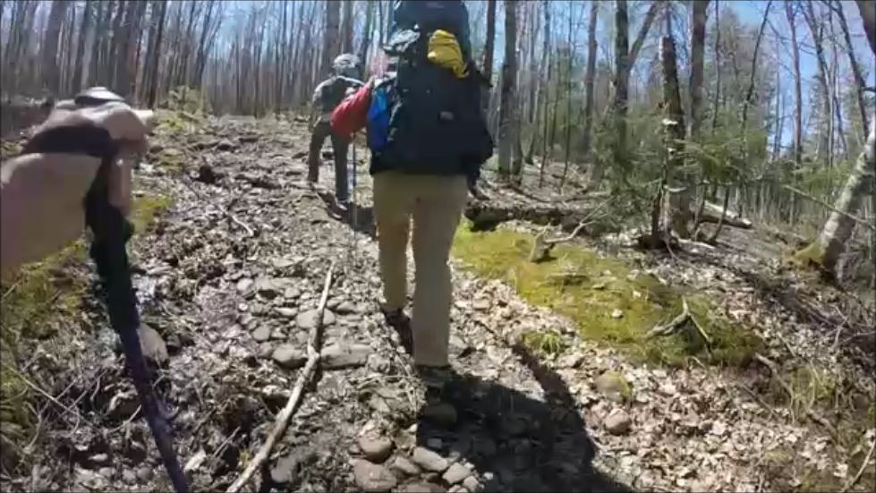
It seems like every hike begins with a hill climb and this was no exception. It wasn't but a few minutes till I started huffing and puffing, wishing for a few level steps! I took a lot of video that I'll edit and post on YouTube but few still photos. But the software I use to edit video allows me to make still's from video scenes. No one remembered a "real camera" so all we had was my cell phone and GoPro Hero3+ Silver. I took the cell phone along primarily to record our track using the BackCountry Navigator app. Thankfully I had remembered to download all the maps of our planned hikes so we didn’t need network service – there is none in the park.
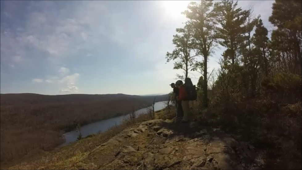
The eastern 4.3 mile segment of the Escarpment trail lived up to our expectations. Being very early Spring there were few leaves on the trees so visibility was great. For much of the way Lake Superior was visible off and on to the north and there were many places where the trail took us to the cliff of the "escarpment" itself providing a number of quite spectacular views of the valley bounded on the north by the escarpment and on the south by a range of hills. The trail is well marked, fairly wide but with many ups and downs and turns, almost all in the woods.
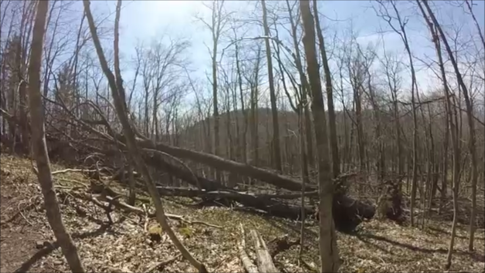
The first major tree brought down by the ice storm a week earlier.
|
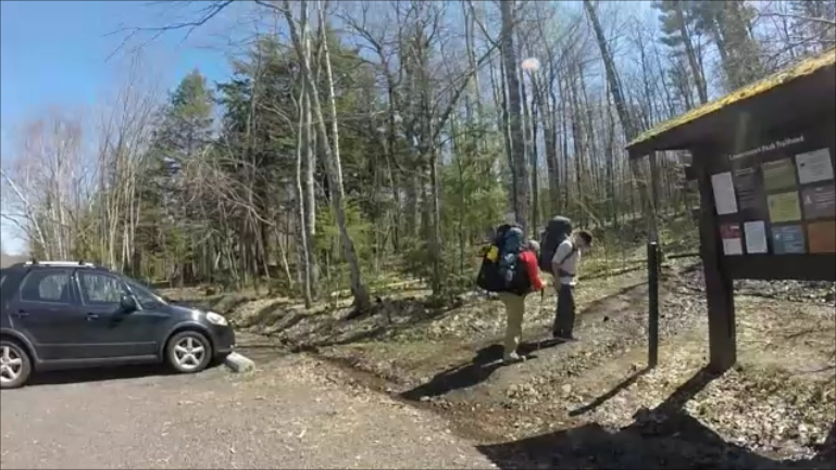
Leaving the parking lot at the beginning of Government Peak Trail on Hwy 107.
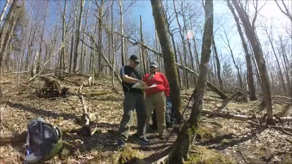
The trail is wall marked with either blue tags or a blew paint spot on the trees but at break we still consulted our map.
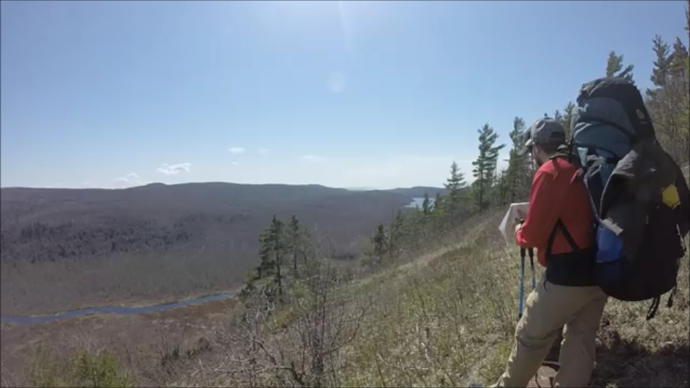 First Glimpse of Lake of the Clouds in the west below the escarpment. First Glimpse of Lake of the Clouds in the west below the escarpment.
It wasn't long before we began seeing Lake of the Clouds one of the most beautiful and recognizable sites in the park. Even surrounded with mostly leafless trees it is spectacular, well worth the trouble! It seemed like hours before we finally made our way to the west end of the lake and then turned south down the steep pathway to a footbridge that crosses the outlet from the lake on its west end. But we did finally arrive in our campsite around 6:00pm with plenty of daylight left to set up, fix our meal and get into our hammocks before full darkness had settled in. The near full moon gave the whole place a glow.
There was considerable evidence of the ice storm a week earlier in the form of downed trees across the trail in a number of places. We were able to deal with all of them by going around, over or under. There is something awe inspiring by those huge hardwoods lying in broken pieces in all directions on the brown, leaf covered ground like toothpicks. Frankly, they are simply huge!
|
Since our planned camp was just around to the left of the far end of the lake it was nice to see it getting closer.
|
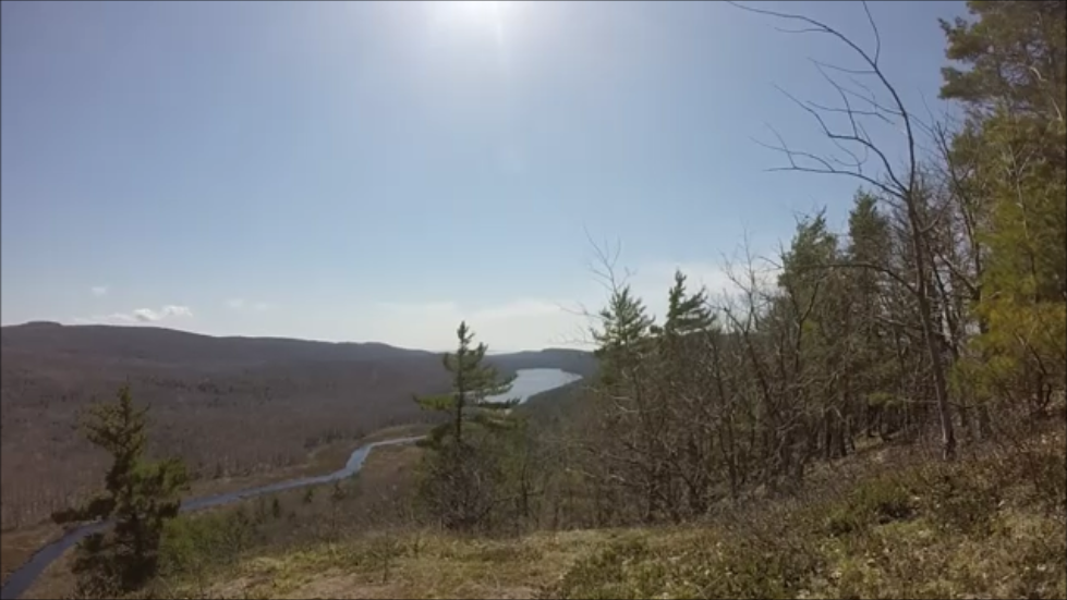
Lake of the Clouds was a beautiful sight that could be seen for much of that fist day's hike.
|
That first night's campsite was a little disheartening. It was the second of three along and near the south side of Lake of the Clouds and would have been much better except for the recent rains and ice. And being so early in the season, cleanup had not been done. But we reminded ourselves that this is a “wilderness park.” Probably the biggest "challenge" was that there was no latrine near the site! There was one on the first site but that required going back quite a way over the long, sloppy tangled trail. Fortunately, only one of our party (I won't name him) had to do the cathole thing. That, it turned out, was the only place where that was necessary!
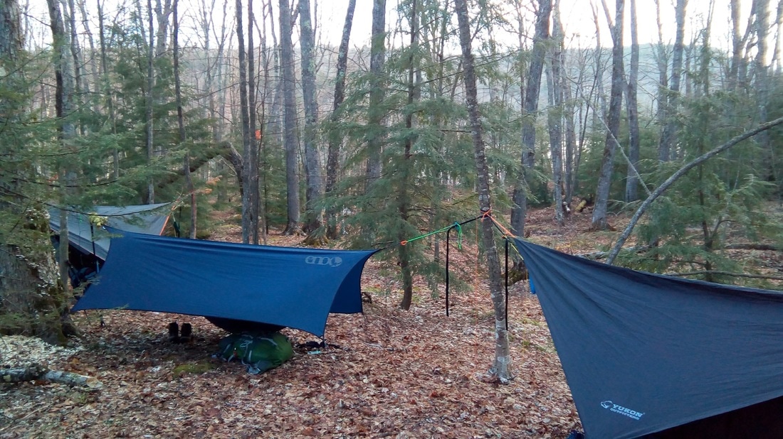
Day 1 Hammock setup at the Lake of the Clouds campsite. This is the only photo I managed to take of the campsite. Looks better in the photo than I remember it!
This was the first time any of us had set up hammocks "for real!" We had all set them up in our back yards and “slept” in them at least part of a night. John and I had actually managed a whole night in some woods near his place on Easter weekend. But there is something fundamentally different about "hanging out" near your house and warm bed, from doing it out in the real woods, hours or days from ANY OTHER possibility of housing!
Initially we selected trees too close together which became obvious when we tried to put up our tarps! In addition, just as we were finishing that first setup, the wind off the lake picked up and we were concerned it was going to be a miserable, windy night. So, we decided to move up the hill further from the lake and a little deeper into the woods AND to find trees that were adequately separated. But John and I tied one end of each hammock to the same tree, not bad except that tree turned out to be a bit too small. So, whenever one of us moved in our hammock, the other felt it!
Then I, the more practiced of the lot, chose a way-too-small tree for the other end of my hammock. Being somewhat stressed out by then, I didn't even think to sit in my hammock 'till bedtime. That's when I realized that this "little" tree, though wasn't likely to break, did bend so that my butt was only about six inches off the ground! We tied that tree to a larger tree with success, in that I didn't land on the ground. But (no pun intended) I was still way too low! Even with all that, we all slept surprisingly well and stayed warm. I'm guessing it dipped into the 30s.
Being in my age bracket, and having a couple other life realities, I had to get up three or four times during the night to tend to business. Besides the sense of relief, those ventures into the forest also kind of reassured me that the bears or other vicious wild creatures were not going to get us as there were no eyes to be seen anywhere in the cold, dark surrounding woods. Except for preferring to be in my nice warm hammock, those ventures into the quiet moon-lit woods were quite pleasant. And each time, I fell back asleep quickly. It was a very good first night in hammocks in the "real wilderness." So, ended the first day and night! Oh, by the way, before we had finished relocating our hammocks due to concern about wind, the wind died down and it was a very calm night!
We had PackitGourmet’s Texas State Fair Chilly for dinner that first night and desert was Caramel flavored instant pudding. I had put the pudding mixture in a plastic bag along with some powdered whole milk so by just adding cold water (which was plentiful), shaking and letting the bag sit, it turned out really creamy and tasty. A nice way to end dinner in the wilderness.
We traveled 4.4 miles with an average speed of 2.3 miles per hour. Our maximum altitude was 1,560 feet and our lowest was 662 feet so we gained 938 feet. And the steepest grade was 72.6%.
Day two started about 6:00am. Our food was untouched on the bear pole (a very nice feature at all the sites we stayed in). The campsite was just as we had left it the night before. And John had water hot for coffee on his Jetboil stove. Life was good.